
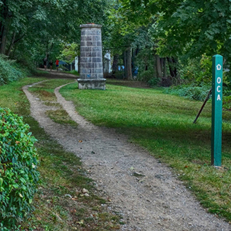
The Old Croton Aqueduct trail is perfect for jogging, hiking, dirt biking and walking with strollers, although some sections of the trail have small stones and occasional tree roots. The trail can be muddy after a heavy rain but, on the whole, drainage is good.
If you are on the trail, you may use the Travelstorys app which is a GPS-based audio guide for walkers and bikers in the area. Only part of the app covers the trail, but it will enhance your experience.
AN EASY WEEKEND VISIT EXPLORE THE TRAIL ONLINE OPENINGS and CLOSINGS on the TRAIL BUY A MAP VIDEO about HUDSON VALLEY PARKS
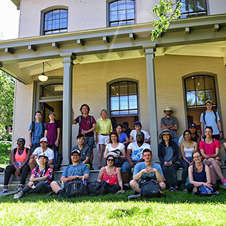


If you're looking for an easy day trip from New York City or elsewhere in Westchester, we recommend first-time visitors take Metro North Hudson Line to Dobbs Ferry (download weekend schedule). There are many restaurants nearby for brunch (Please check to see their status during Covid-19 isolation period). You can walk up the (steep) hill on Walnut Street to the Keeper's House Visitor Center which is open Saturdays and Sundays from 1pm-4pm. We have maps there, as well as an exhibition about The Aqueduct, helpful docents, bathroom, water and an interactive kiosk to plan further walks.
There are two options from The Keeper's House: You can hike north about 3.5 miles to the Lyndhurst Estate and the Riverwalk. On the way you can take a look at The Octagon House (they give tours on weekends, but you must register in advance). To return from Lyndhurst you would have to walk about 30 mins back down to Irvington, which is a scenic town with lots of resturants. Alternatively, you can walk about 3.5 miles south on the trail from The Keeper's House to Untermyer Gardens. Untermyer is a beautiful place for picnics, and is directly uphill from the Greystone MTA station for your return trip.
If you are not starting at the Keeper's House, we strongly recommend that visitors order our Map/Guide before arrival, as without it you may have difficulty navigating some of the trail's detours. Less-detailed FREE MAPS you can download and print are also available.