One of our members, Carlos Gee, has walked the entire length of the Westchester trail (thereby earning a PATCH!). His excellent blog, Scenes from the Trail, recounts his multi-day journey, with helpful tips and photos of what he saw along the way. He was kind enough to allow us to reproduce his blog entries on our site. Thank you Carlos!
October 8, 2016 – Tibbetts Brook Park to Van Cortlandt Park
Difficulty: easy
Length: approximately 5 miles
Route type: linear
Maps: 1. Old Croton Aqueduct Trail – Westchester Section – 2. Van Cortlandt Park
This is the fifth and final leg of my section hike on the 26.2 mile Westchester County portion of the Old Croton Aqueduct Trail.
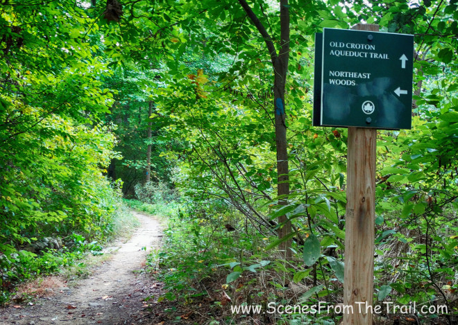
Temperature was in the low to mid 60’s and no rain, a perfect October Saturday for hiking. As always, with a linear hike, we spotted cars. We drove down to Van Cortlandt Park and parked in the Riverdale Stables, which is at northwest area of the park on Broadway. We then drove to Tibbetts Brook Park, which would be our starting point. Since we didn’t have much distance left to complete our goal of reaching the Yonkers – Bronx border, I thought it would be cool to continue on the aqueduct through Van Cortlandt Park and explore others area of the park as well. Once we were parked and geared up, we headed out on a trail from the parking area up to the aqueduct.

trail from the parking area
We walked beneath Teresa Ave, which is the entrance road to Tibbetts Brook Park.

Teresa Ave
We then turned right onto the aqueduct which is paved in this area and walked beneath Teresa Ave. again under the stone arch bridge.

stone arch bridge

stone arch bridge
In a little less than a mile we came to a ventilator shaft. From Spring Street in Ossining (ventilator shaft 8) to Tibbetts Brook Park (ventilator shaft 23), they are numbered, on the shaft itself and on the map. This one wasn’t numbered in either place. It is also the last one in Westchester County heading south on the aqueduct.

ventilator shaft
Not too far after we passed the ventilator shaft, we arrived at the Westchester County – Bronx County border of the aqueduct, which was delineated by a large boulder in the center of the aqueduct trail.

Bronx – Westchester boundary
The boulder has a nice NYC Parks plaque on it.

NYC Parks boundary marker
We had completed what we had set out to do. The entire Westchester Section of the Old Croton Aqueduct Trail, all 26.2 miles. We could have completed this on our last hike, but I wanted to continue into Van Cortlandt Park and explore it a little, so on we went, still following the aqueduct.
OCA – Van Cortlandt Park
After hiking for 45 minutes we arrived at a weir chamber in Van Cortlandt Park. Here is where we took our first break. This was supposed to be our ending point of our original OCA hike, but today we had a lot of hiking yet to do.

weir chamber – OCA – Van Cortlandt Park

weir chamber – OCA – Van Cortlandt Park
Once we were done congratulating ourselves for our monumental achievement, we decided that we would hike the rest of the aqueduct in the park, then hike the Putnam Trail, which ran practically parallel to the aqueduct. At this point, my aqueduct map was of no use. I didn’t have a NYC Aqueduct map and had to rely solely on the Van Cortlandt Park map which we downloaded off the NYC Parks website. This map worked well enough when traveling on their trails, but the OCA is just a white line on the map, which in some places branches into several more white lines. Luckily for my superb navigational skills, we only back tracked several times. Signage was minimal moving forward and I really didn’t mind just wandering the park, venturing on and off the aqueduct and onto the park’s trails, some which were on the map and some that weren’t.

Van Cortlandt Park
Although Van Cortlandt Park is quite scenic, there are sections of the park that are desolate and probably should not be hiked alone. We encountered various questionable characters in the more secluded areas. The broken lampposts were a subtle reminder to be aware of your surroundings.

Van Cortlandt Park
As we wandered through the park we passed by the Mosholu Golf Course and came to a wall that looked like it belonged on the outside of a prison.

stone wall
We turned left at the wall and walked alongside it. We came out on Jerome Avenue and realized we were a little off. We then retraced our steps through the woods back past the Mosholu Golf Course until we came out onto West Gun Hill Road and walked west towards Van Cortlandt Park South and crossed over the Major Deegan Expressway (Interstate 87) and then entered Van Cortlandt Park opposite of Putnam Avenue, which I correctly assumed was where we could find the Putnam Trail. We walked on a carriage road and arrived at an intersection where an old railroad bridge was just off to the right.

Old Putnam Railroad Bridge – Van Cortlandt Park
We climbed up onto the trail here, just to the right of the tree. This was indeed the Putnam Trail which follows the route of a commuter train that ran from the Bronx up to Brewster, NY for almost a century. It was abandoned in 1958 and for most of it’s length, it is now used as a rail trail.
Old Putnam Railroad Bridge – Van Cortlandt Park
Not too far from the bridge we came to the skeletal remains of Van Cortlandt Station. The New York and Putnam Railroad had two stops in The Bronx: Kingsbridge and Van Cortlandt Park.

skeletal remains of Van Cortlandt Station
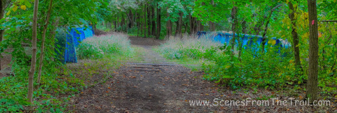
We continued walking north along the old railbed and across a two track railroad bridge.
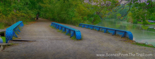
Old Putnam Railroad Bridge – Van Cortlandt Park
We were now walking alongside Van Cortlandt Lake enjoying the scenery. This 18 acre lake is the largest freshwater lake in the City.

Van Cortlandt Lake
Then we came to the Grand Central Stones which was something I had read about and was wanting to see. The New York Central Railroad placed the different types of stone here to determine which would be most durable for use for the building of Grand Central Terminal in Manhattan. They ended up choosing the stone that was the cheapest to transport along their rail lines which was Indiana Limestone, the second one from the left.

Grand Central Stones
After checking out the stones and admiring the lake we continued on the Putnam Trail which was now getting quite crowded. It seems that there was a cross country meet in the park and there were thousands of runners racing along in groups.

Van Cortlandt Lake
We eventually veered off the trail onto the The John Kieran Nature Trail, which still had groups of runners, but considerably less than the Putnam Trail.

John Kieran Nature Trail

John Kieran Nature Trail
We came out from the nature trail onto the Parade Grounds which was along Broadway. There were thousands of people here for that track meet and it was time for us to go. We walked on the track alongside the Parade Grounds and crossed over the Henry Hudson Parkway on a footbridge while hundreds of runners were crossing at the same time. We veered left onto a carriage road which brought us back to the Riverdale Stables parking area where we had spotted the first vehicle. No sooner had we gotten in the car and it started raining. Timing is everything right? We jumped on the Henry Hudson North and drove back to Tibbetts Brook Park where our hike began. From there we headed back to eat some salty Chicken Teriyaki which I had in the slow cooker. Luckily the day was saved by some fantastic appetizers and a scrumptious ice cream cake, which was not made by me. I hope that you enjoyed the hike. Don’t forget to follow my blog and stay informed about great hikes in the Hudson Valley and beyond. So get out there and take a hike!

take a hike!